
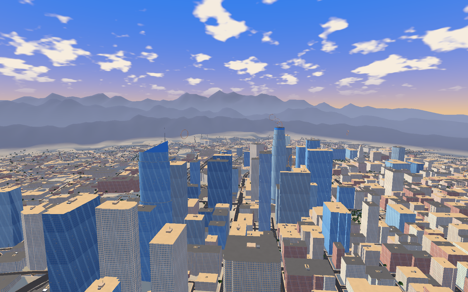
Before Jetpack Pals became a multiplayer adventure, it started with a much simpler idea: fly over Los Angeles. Explore the skyline, move between the towers, and see a familiar city from a completely different angle. That original Los Angeles fly-over game became the starting point for Angel City.
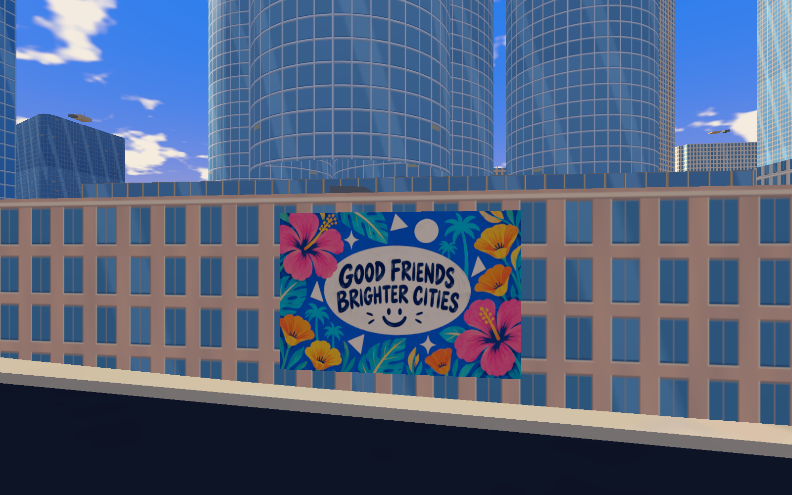
Los Angeles is still deeply embedded in the world we’re building. You can see it in the downtown towers, the freeway connections, the palms, and the way the streets run between blocks. The skyline above is a development render from our painted city pass. Below, we’re sharing some of the references and work-in-progress images behind it.
It started with the view
A city takes on a different character when you can fly through it. A tower becomes something to climb past. A street becomes a line you can follow from above. Rooftops become part of the landscape instead of places you never see. Downtown Los Angeles gave the original game a strong foundation for that kind of exploration: tall landmarks surrounded by lower buildings, long sightlines, and streets that connect one recognizable place to another.
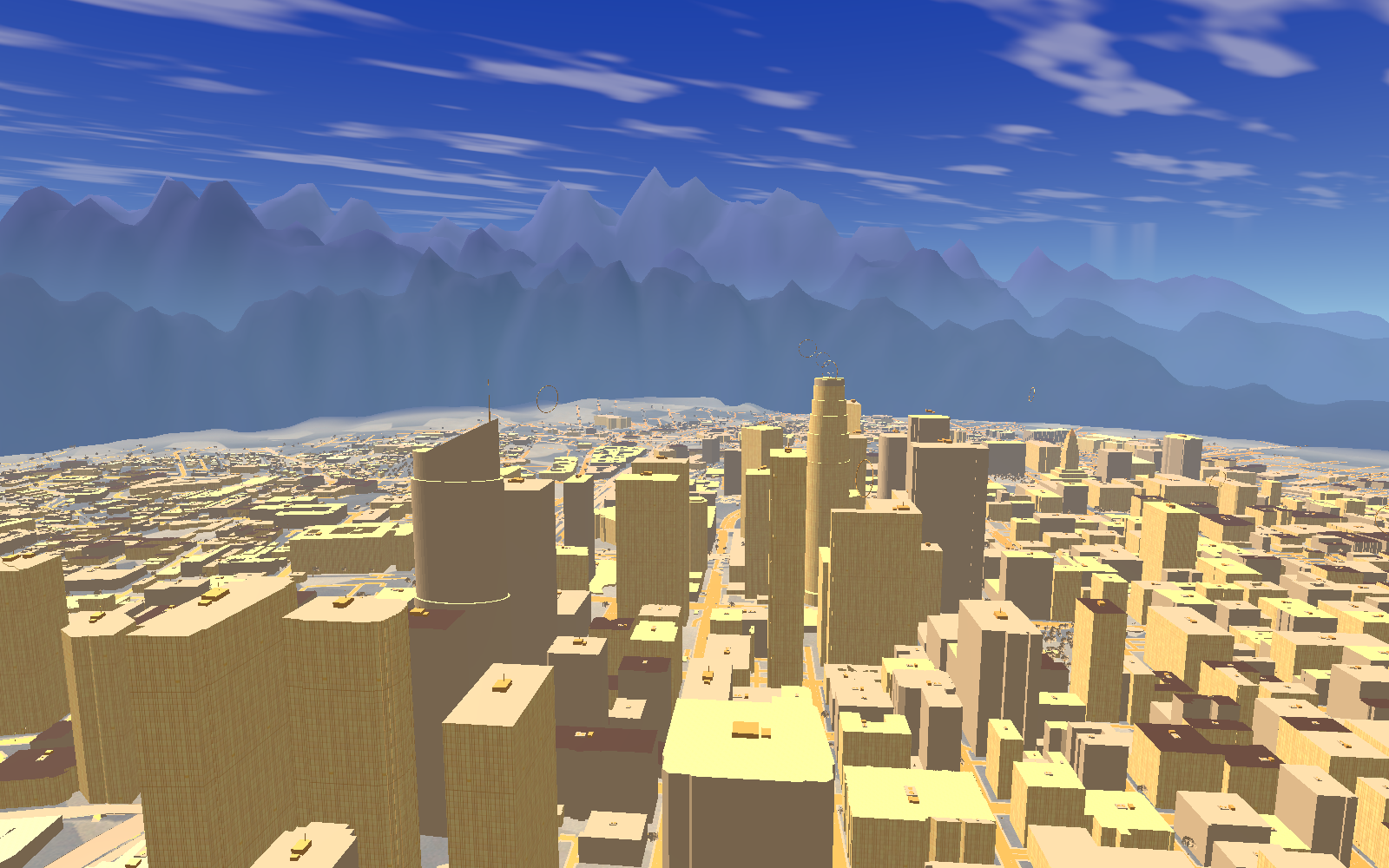
As the project pivoted toward multiplayer, the purpose of the city changed. We began designing for the idea of sharing that space with friends: finding each other, choosing a direction together, and turning a flight across town into a shared adventure. Angel City grew out of that shift. The Los Angeles foundation stayed, while the world around it began taking on the personality of Jetpack Pals.
A real city gives us somewhere to begin
One of the most useful things about building from Los Angeles is that the infrastructure already exists in the real world. There are streets to follow, intersections to connect, blocks with defined shapes, and landmarks with a place in the skyline. Those relationships give us a starting point for decisions we would otherwise have to invent one by one.
Our downtown source uses OpenStreetMap building footprints, street geometry, and available building heights. That means the model starts with actual relationships between roads and buildings. We still have to turn those inputs into a playable environment, build the architecture, solve awkward road connections, and give the surfaces their own visual identity. But we can spend that effort developing an existing place.
The aerial reference also taught us where a photograph stops being useful as a game surface. It contains rooftops, cars, trees, and shadows captured at one moment in time. Put modeled buildings and vehicles over that image and those details can appear twice. We moved the ground toward a drawn surface derived from the same street network, so the modeled city and the game’s lighting can work together.
Street names are useful development tools
Real street names make the city easier to discuss, build, and revisit. “The warehouse off East 4th” gives a location context. “The Broadway block” gives us a place to check. A recognizable intersection is much easier to remember than an anonymous patch of geometry.
That usefulness already reaches into the prototype. Emergency callouts can point to named cross-streets, and traffic uses the mapped road network. The lab has a location off East 4th. A street-prop placement pass began with a small Broadway pilot before expanding across the city. Geography becomes a common reference for art, placement, navigation, and gameplay.
Landmarks help at a larger scale. Our source city includes interpretations of U.S. Bank Tower, Wilshire Grand, the Westin Bonaventure, City Hall, Walt Disney Concert Hall, and The Broad. They give the skyline recognizable reference points, helping us judge where a view is facing and how one part of downtown relates to another. As we design for multiplayer, that same clarity can help players describe where they are and where they want to meet.
Giving Los Angeles the Angel City treatment
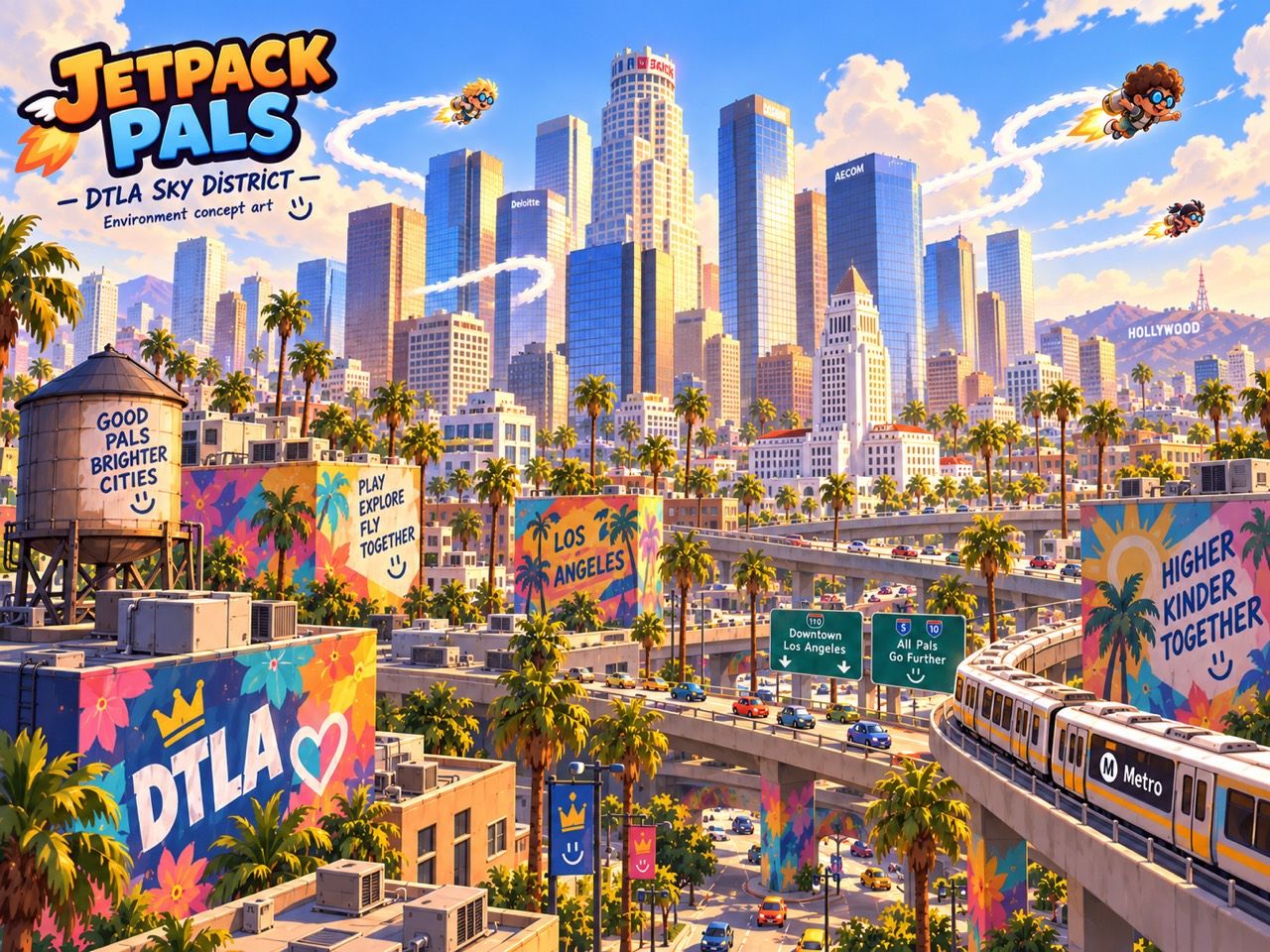
The visual direction pushes toward blue reflective glass, warm limestone and terracotta, soft cream clouds, and violet depth in the distance. Murals add pink, teal, cobalt, and gold at a more personal scale. These choices let the city carry the cheerful energy of the Pals while keeping the downtown structure recognizable.
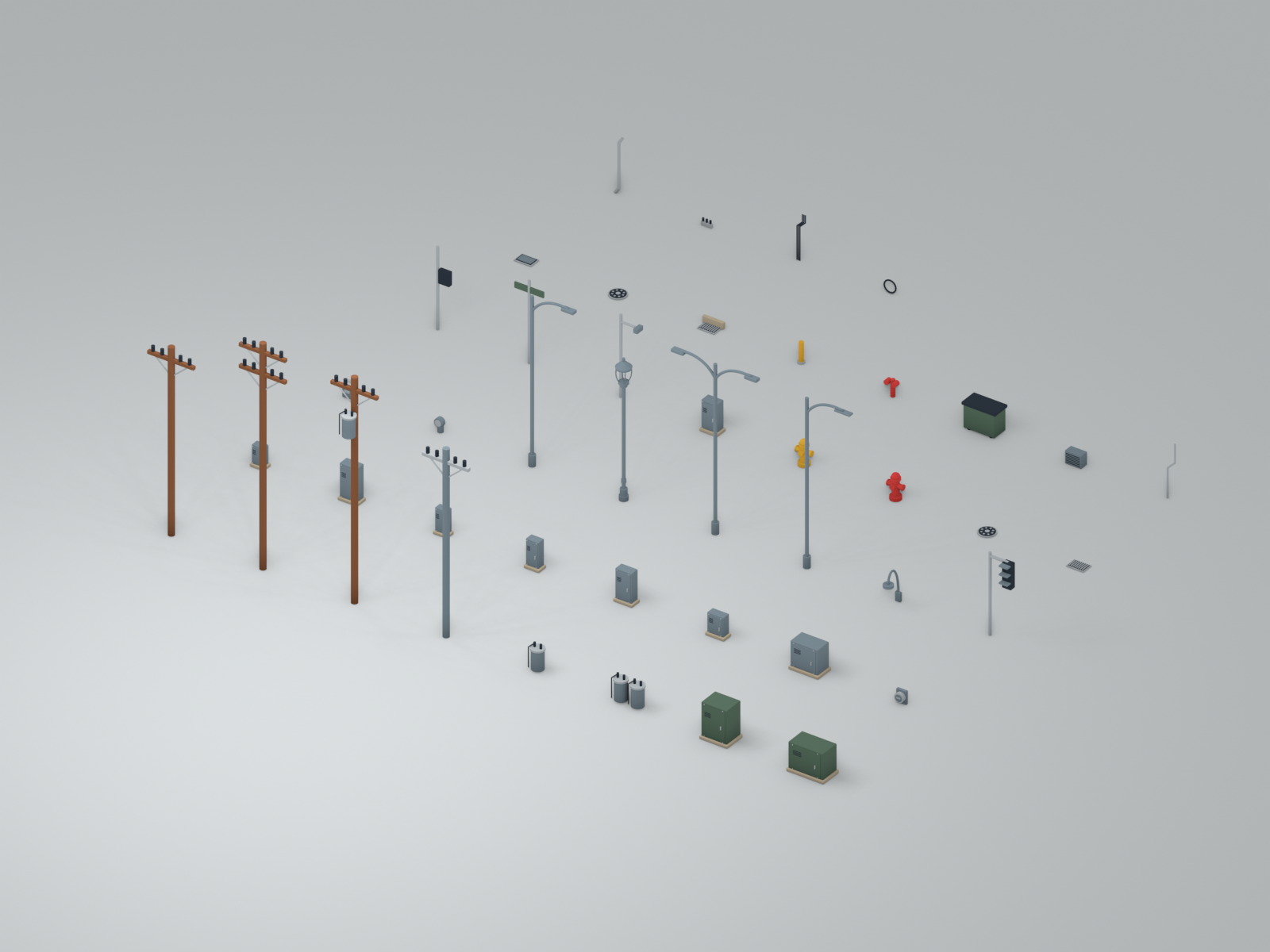
The smaller infrastructure matters too. Sidewalks, curbs, lamps, utility poles, cabinets, drains, and hydrants give streets a sense of everyday use. Our Blender utility kit lets us build that detail consistently, then choose combinations that suit different areas, from historic Broadway-inspired blocks to warehouse streets.
Even the ground underneath the streets changes the experience. The game uses real elevation data to bring downtown’s slopes into the model. Bunker Hill needs to feel like a hill. Those changes in height affect how buildings meet the ground, how roads climb, and what comes into view as you fly.
A familiar foundation, room to grow
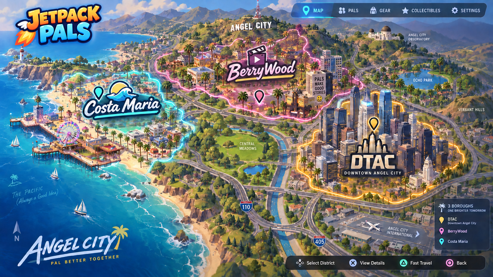
Angel City gives us room to develop our own neighborhoods, stories, and sense of adventure around a place that already has a strong structure. The source model is an artistic reconstruction, and the wider concept map explores how that inspiration might grow into a more fictional world.
The original fly-over idea is still at the heart of it: there is something wonderful about lifting off and seeing the city open up beneath you. The multiplayer direction gives that feeling somewhere new to go. We want Angel City to become a place you learn together, where a familiar street or a tower on the horizon can be the start of the next flight with your friends.
References behind the city
Building footprints, road geometry, street names, and available heights: © OpenStreetMap contributors. Data is available under the Open Database License (ODbL).
OpenStreetMap attribution and license
Aerial reference: USDA National Agriculture Imagery Program, accessed through the USGS National Map imagery service. The source was retrieved September 5, 2026; this is not the date the aerial photographs were taken.
USGS National Map imagery service
Architectural references recorded with our city source include Pei Cobb Freed & Partners’ U.S. Bank Tower project page and the Wilshire Grand Center website.
U.S. Bank Tower — Pei Cobb Freed & Partners
Terrain: AWS Terrain Tiles (Mapzen/Tilezen), checked against USGS 3DEP elevation points during development. Game renders, concept illustrations, and the Blender kit shown here come from the Jetpack Pals project assets.